Hiking in the Old Ingraham Highway Trail of Everglades National Park

|
| The Old Ingraham Highway in Everglades National Park - License our images here. |
No more vehicles in this route from the past. The Old Ingraham Highway - or what remains of it - is now the longest official trail of Everglades National Park.
This road from the 1920s was the land connection to Flamingo before the national park. It crossed through an area of farms called the "Hole-in-the-Donut". Some of the old farms are still visible in satellite images - check here and here.
After the government bought these lands and left them under the rule of nature, the invasive Brazilian Pepper took over. They are still trying to eliminate these trees since the 1990s.

|
| Wetlands seen from the trail. |
The main road of the national park completed in 1957 didn't use this section of the Ingraham Highway. It went through new grounds, making a big curve around Long Pine Key.
 |
| Map circa 1947 showing the Old Ingraham Highway through Everglades National Park. You can see the part of the road that became a trail comparing to the trailhead map in the next picture - State Archive of Florida/Beard. |
The engineers thought that the old highway with long straight sections would be boring for the park visitors. The new road also gave direct access to spots with better views of the slough and the "river of grass" - among them the Mahogany Hammock and the Pa-Hay-Okee Lookout
Tower. We've a photo of Mahogany Hammock in this post.

|
| Map of the trail of the Old Ingraham Road. It goes from near Royal Palm Visitor Center to nowhere. |
When the park bought the lands of the Hole-in-the-Donut and all farming ceased in 1975, the Old Ingraham Road was closed to traffic and designed for hiking and biking.
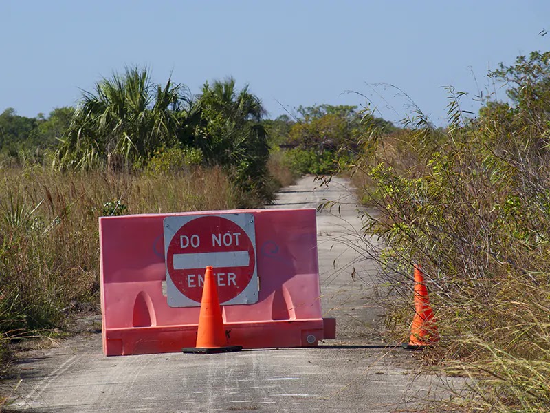
The long trail goes nowhere. One way in, one way out. Also, the area is pretty remote. We didn't see anyone after Gate 15.

|
| The wide part of the Old Ingraham Highway Trail - No trees and no shadows. |
Our hike began from the Royal Palm Visitor Center parking area. On the way to the Old Ingraham Highway Trail, we stopped by Hidden Lake. The Environmental Education Center was closed.

|
| Hidden Lake by the Old Ingraham Highway - it's well hidden. |
Old Ingraham Highway Trail is open to vehicles up to Gate 15. After this point, it's just for hikers and cyclists. It gets narrow.

|
| Gate 15 in the Old Ingraham Highway Trail. |
Five miles later, after the curve, it's the Ernest Coe backcountry campsite. Primitive and bushy area. The other backcountry site called Old Ingraham is at the end of the trail.

|
| Where is momma? |
Deeper on the trail, the vegetation spills over the path. We found some muddy parts and didn't reach the end - too many miles for the Florida sun. Maybe we can try the whole road one day with the bikes.


Comments
Post a Comment